 |
7 The Historical Landscape
In this section
Overview
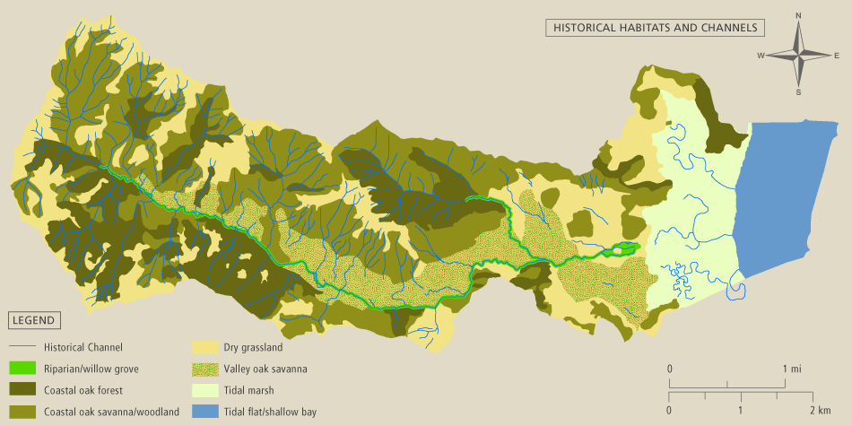
The historical landscape of the watershed contained several different habitat types. Historical data were analyzed in order to determine the size and location of historical habitats. The creeks and habitats were mapped using GIS.