 |
8 The Changing Landscape
|
Map created by the San Francisco Estuary Institute. Green Boxes depict landscape |
||||||||
|
|
 |
 |
 |
|||||
In this section
Changes in the Valley
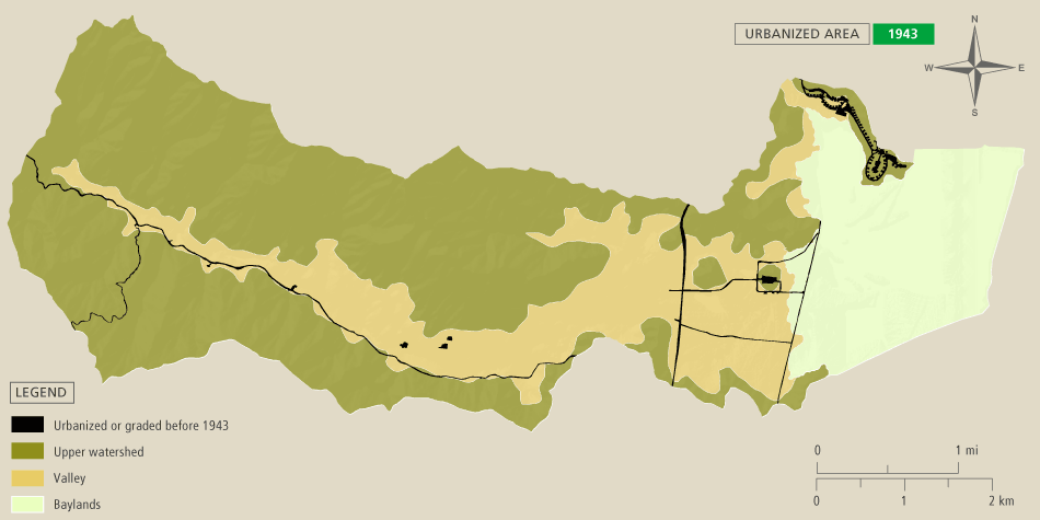
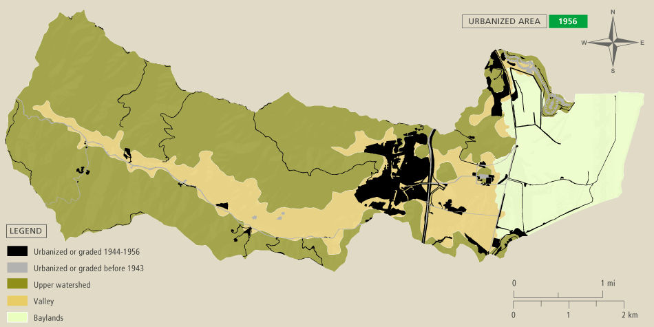
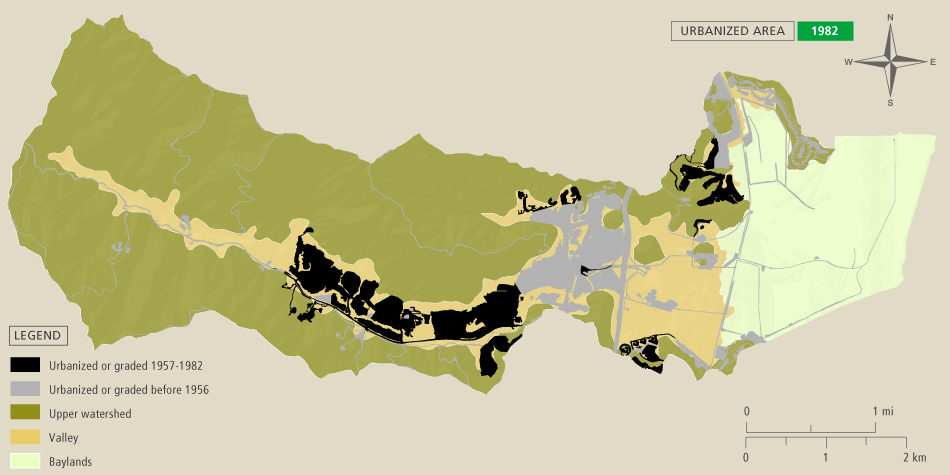
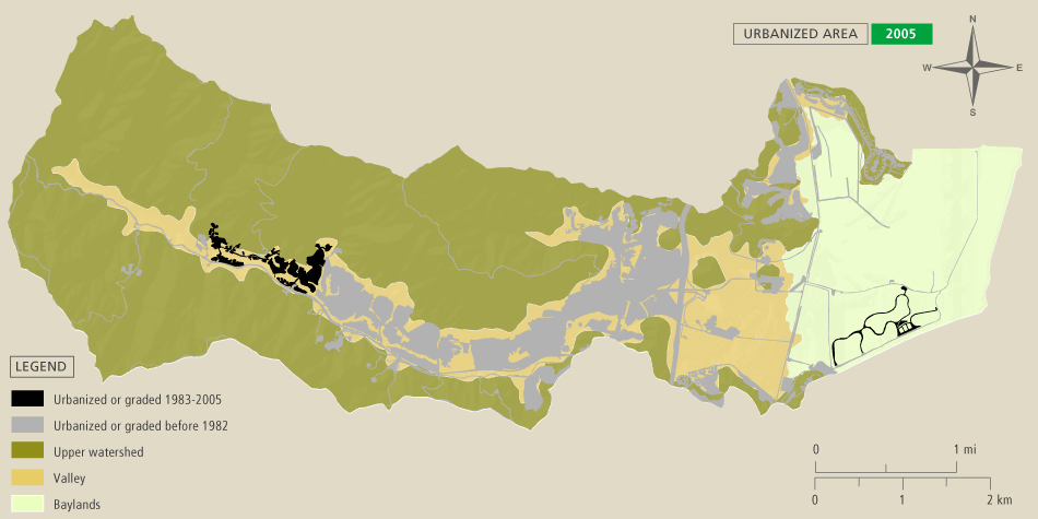
Urbanization of the valley
From the late 1950’s and into the 1980s, expanding residential suburbs were built in the valley. Storm drains, sewers, power lines and communication systems were added. As the number of people living or working in the watershed increased, the supporting infrastructure was further developed. The construction of Highway 101 included successive widening projects and HOV lanes. Natural processes such as flooding and creek migration have been constrained in favor of using floodplains for agriculture, housing and other development. Agriculture has largely been relocated from the valleys to the diked baylands.
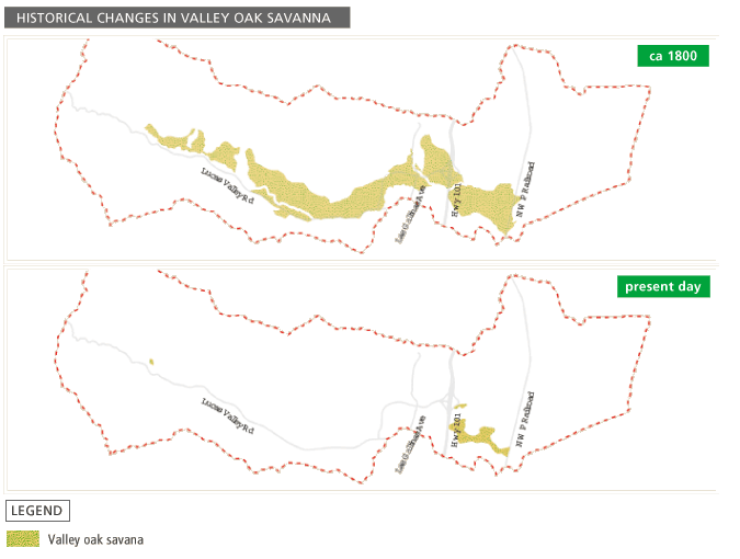
Loss of valley oaks
Cattle grazing and urbanization in the valley have reduced the historical extent of valley oak savanna by over 90%.
 |
|
The area of valley oak savanna has decreased by over 90% |
Alteration of valley wetlands
Most of wetlands on the valley floor are now artificially drained. Historically, seasonal wetlands existed in topographic lows between the low hills north of the St. Vincent’s access road. Remnants of these wetlands still exist. The lower reaches of the drainage ditch that conveys urban runoff from Marinwood to the diked baylands south of St. Vincent’s support willows that might be remnants of the willow grove that historically existed at the end of Miller Creek.