 |
8 The Changing Landscape
In this section
Changes to Creeks and Riparian Habitat
Health of Miller Creek
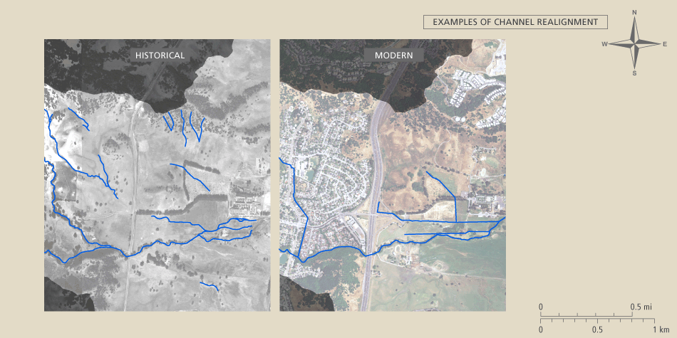
Miller Creek and its tributaries have been significantly altered by land use practices since Euro-American contact. Heavy cattle grazing, the conversion from native perennial to non-native annual grasslands, urbanization, ditching and the construction of storm drains have all increased the amount and depth of runoff during storms. The increased runoff has caused channels in the upper watershed and in the upstream reaches of the valleys to erode their beds (i.e., incise), leading to local bank failure and loss of riparian vegetation. The eroded sediments have accumulated upstream of some bridges and culverts that act like sediment dams, and along the lower limits of the mainstem channel near the baylands. The accumulation of sediment in the mainstem channel has raised its bed and increased the risk of flooding. Flood control levees have been added in some places.
Channel incision and agradation
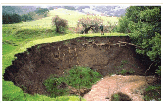 |
This photo depicting rapid erosion was taken in the early 1980s, |
The Grady Bridge can be used as a reference point for the process of channel incision (down-cutting) and channel aggradation (sediment accumulation) of the channel bed. The bridge incorporates a cement apron that crosses the channel and prevents the bed below the bridge from adjusting its height. The bed has aggraded to the height of the apron on its upstream side. On the downstream side, the bed has incised more than 10 feet. The incision will eventually threaten the integrity of the apron. If it fails, all of the sediment stored behind it will be mobilized, causing aggradation, and potentially flooding, someplace downstream.
Culverts and revetments
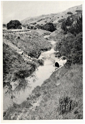 |
Culverts emptying into Miller Creek near Lucas Valley |
Other obvious land use impacts to the stream ecosystem include the routing of a major tributary into a buried culvert near Blackstone Canyon, and the construction of a straight concrete flood control channel in Marinwood. These kinds of alterations can reduce many stream ecological services, including the support of steelhead and other anadromous fishes. Revetments to prevent bank erosion are common but not ubiquitous throughout the urbanized valleys. While revetment can slow bank erosion, it cannot stop it, especially where the channel is incising. Revetment tends to require ongoing maintenance with occasional replacement. Levees and revetments can lead to downstream incision by confining flow, thus increasing water depth and its power to erode. Mapping all of these various channel modifications would be helpful for quantifying their impacts and identifying what, if any, changes in stream engineering and land uses might be warranted.