 |
8 The Changing Landscape
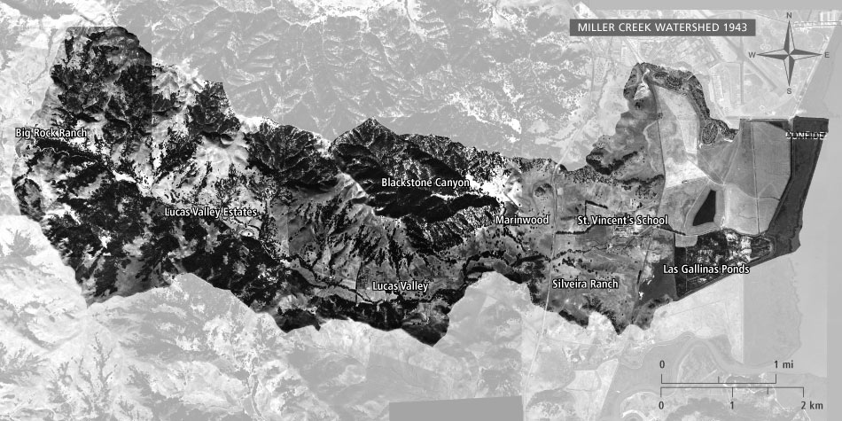
Aerial photo source: U.S. Department of Agriculture (USDA) 1943. Map by San Francisco Estuary Institute, 2008.
In this section
Overview
Since the early 1800s, the watershed has been changed by a succession of land uses. This section describes how the different sections of the watershed have changed over time.