 |
7 The Historical Landscape
In this section
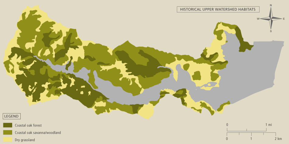
Upper Watershed Habitats
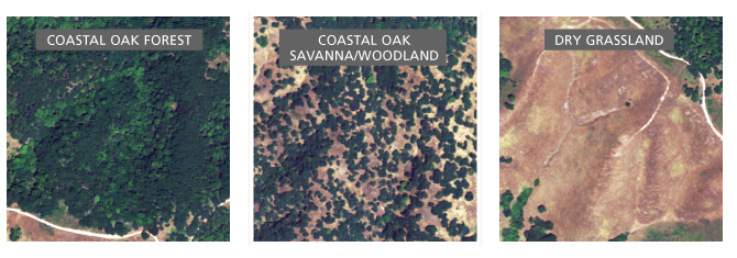 |
Habitats in the upper watershed were mapped using historical (USDA 1943) and modern (NAIP 2005) aerial photographs. Coastal oak forest consists mainly of coast live oak (Quercus agrifolia) as well as California bay (Umbellularia californica). Areas in the photos depicting a tree canopy dense enough to hide the understory were mapped as forest. A more scattered arrangement of live oaks and grassland was mapped as coast live oak savanna/woodland. Areas without trees were mapped as dry grassland. These three components of dry land habitat were mapped at a fairly coarse scale (1:5000). The few areas of brushland and chaparral were small and therefore included in the surrounding coastal oak forest or savanna/woodland.
While we are confident about the historical presence of these habitats, we are less sure about their historical spatial extent. The relative amounts of grassland and forest might have changed significantly since the cessation of native land management practices (circa 1800), especially the controlled use of fire. The mapped areas of these habitats are probably correct within 50%-200% of their true historical extents.